非常感谢 Loci 将以下授权ALA-Designdaily发行。
Appreciation towards Loci providing the following description:
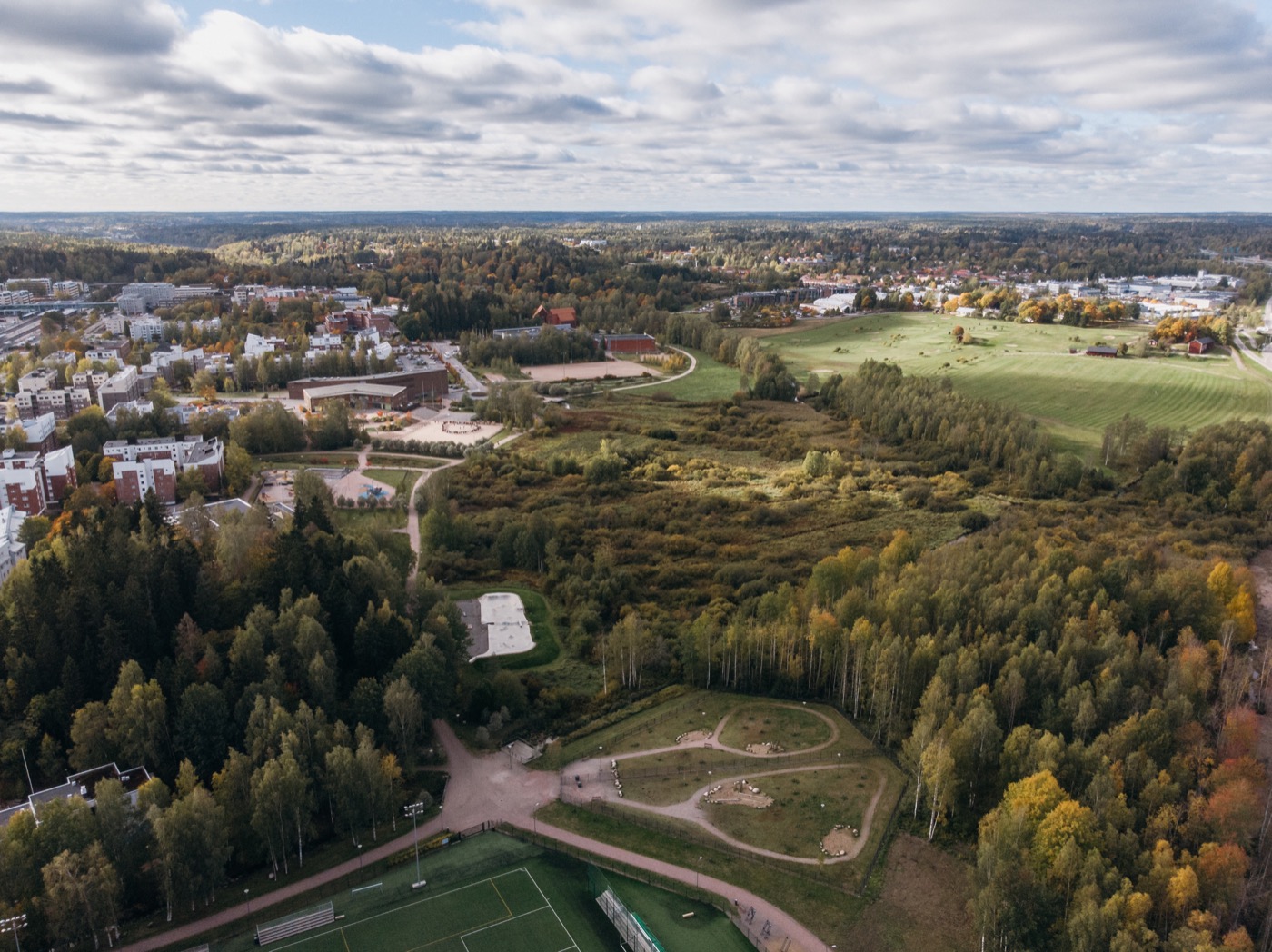
Kirkkojärvi Park is a green oasis in the Espoo river valley. The idea of the park is based on the dynamic movement of the water and sculpting the ground. The former lake that was at the area was brought to the landscape as a symbolic, open flood field. The lake returns to the landscape when the river floods.
Kirkkojärvi Park is located in central Espoo, the second largest city by population in Finland. The park used to be a lake but was drained in 1959 with the building of Finnish National Road 1. The River Espoonjoki runs through the scrubby wetlands of Kirkkojärvi.
The Espoonjoki floods frequently because of meltwater in the spring and heavy rainfall in the autumn. In addition, climate change has made flooding during the winter more common. Flooding blocks the light transportation routes and playing fields in the riverside area.
The small figures above present four different water levels in Kirkkojärvi before the flood management operations. The first figure on the left shows the mean water level, which is an averaged height of the water in the area. The last figure on the right shows occasions where the water level rises so high that it covers all the playing fields and the riverside route and reaches several buildings built on low-lying ground. For example, level +4.73 msl is a calculatory water level of floods occurring once in twenty years in Kirkkojärvi area.
The flood management was achieved mostly by stabilising and raising critical parts of the riverside route. In this way, the flooding Espoonjoki would stay in its riverbed and the riverside park can be in use most of the time. The figure above and cross-sections below show the procedures undertaken in Kirkkojärvi Park.
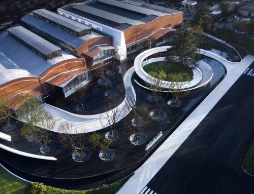
The water is the heart of the new recreation area, as well as a challenge in planning. The riverbed was reshaped and planted, and new seating places were added to the riverside. The wooden lookout deck in Kaivomestari Square offers a panoramic view of the river valley. It also hides the big stormwater pipes underneath.
The floods and the constantly changing landscape in Kirkkojärvi Park make it a particularly exciting, interesting and memorable place. The path in the southernmost part of the park divides Kirkkojärvi Park into two distinct areas: the open floodplain of the River Espoonjoki in the north and the functional spaces in the south and east.
The overall idea was to create an ecological plan in which the design of the terrain and dynamic water movements are the central principles. The role of the park path as a symbolic old Kirkkojärvi shoreline was emphasised with natural stones, grasses, and riverside vegetation. New sectorally planted trees intensify the spatiality and give borders to the long views of the river valley.
The upper picture below shows the Espoonjoki in its normal state. The picture below it is edited to showcase a level +4.73 msl flood in the improved, flood-resilient Kirkkojärvi Park.
Kirkkojärvi Park also has an important role in raising environmental awareness. The flood management solutions and dynamics of the environmental processes are brought to the attention of park-users by locating information signs and water-level indicator posts along the park path.
Type: Open Competition
Project name: Kirkkojärvi Flood Park
Office: LOCI Landscape Architects
Website: www.loci.fi
Client: City of Espoo
Design: 2011-2014
Completion: 2014
Photographs: Pyry Kantonen Photography

评论